Fiber, Access and Data Center Construction in Anadarko, Oklahoma
Network reach decides whether a Caddo County site can host a data center, and the first job is to learn which carriers already pass the parcel and which roads they follow. Fiber tends to share a corridor with the highways and the freight line, so we begin a connectivity review by laying the road map, the rail line and the known conduit routes over the survey. A site with two separate ways in for cable, and a delivery route for heavy equipment from the same frontage, is worth more here than extra acreage.
Anadarko gives a buyer a few useful reference points. Union Pacific rail runs through the town on a line that began under the Rock Island name. US-62 with State Highway 9 meets US-281 with State Highway 8 in the middle of it, and Chickasha is about 18 miles to the east. Those crossings are where carriers, utilities and trucks all converge, so we study them before choosing an entrance or a conduit path.
We build edge and enterprise facilities for owners who need dependable connectivity away from the large metros, and we work with the county, the carriers and the electric provider early. Power is the second constraint, and we touch on it below, but the first drawing is a map of access.
Public and tribal operators near the Washita
In 2000, federal and tribal offices in town, including the Bureau of Indian Affairs and the Indian Health Service, together employed 540 people, and agriculture has long been the economic mainstay. Organizations of that kind keep patient records, benefit files and program data that must stay available, and many of them prefer to host it close to the people who use it. Our government and defense operators page describes how public owners specify access control, redundancy and audit trails.
Regional carriers are the other natural customer. A small switching or meet-me room along a rail and highway corridor can serve rural exchanges and health clinics, and telecom and network carriers will usually ask for diverse entries, secured cable vaults and generator backup. We design the building and the cable paths together, so the room is not built before the routes are known.
Agricultural cooperatives and processors round out the list. Their needs are modest, a server room with clean power and a link to the outside, but they depend on that link at harvest time, and they value a builder who explains the limits of a rural network in plain terms.
Reading the corridor before choosing the lot
We rank an Anadarko parcel on four questions in order: which carriers reach it, how many separate routes can enter, who owns each right-of-way and how long the permits take. A road crossing, a rail crossing and a creek crossing each add approvals, and a route that must cross the Union Pacific line can take longer to approve than the building itself. Where the best fiber path is blocked by a crossing, we look for a parcel on the near side of it.
The Washita River runs along the south side of town, and its valley has long supported crops and livestock, which means flat, productive ground that landowners may be reluctant to sell. We ask early about the owner's intentions, about floodplain mapping and about drainage, because a river terrace can look level and still collect water. A raised pad and a clear path for runoff solve most of what we find.
With a parcel chosen, we price the fiber and telecom trenching for each candidate route in the same format, so the owner can compare cable cost, schedule and risk without translating between proposals.
Approvals that touch roads, rail and the grid
A project here goes through zoning, the local building department's review of structure, fire protection and electrical plans, and the utility's service process. Cable work adds right-of-way permits from whichever agency controls the road, and any crossing of a rail line requires the railroad's own consent. The railroad sets its own timetable, so we send that application first.
Our permitting and utility interconnection service puts the city, county, railroad and electric provider on one calendar. We prepare complete packages, track comments and tell the owner each week which approval controls the date. Interconnection studies, transformer orders and switchgear submittals sit on the same chart, since the power timeline can run longer than the building schedule.
From Anadarko toward Chickasha, Lawton and Mustang
Anadarko sits at a junction of two U.S. highways and two state routes, with Chickasha about 18 miles away and Lawton and Mustang within reach on the regional road network. Trade partners, testing agents and deliveries can come from any of those directions, and we choose the approach for each major item after checking bridge limits and turns.
Owners comparing these markets can ask us for the same connectivity map and power review for each. The answers differ: one place may offer a second carrier, another a shorter utility extension, and a third cheaper ground. We put them in a single table so that the decision rests on the same questions everywhere.
Heat, cold and rainfall on the job
Yearly precipitation in Anadarko comes to 31.63 inches, and the thermometer has recorded 111 degrees Fahrenheit at the top and minus 17 at the bottom. Those extremes affect a data center design and a construction schedule. Cooling equipment must be rated for the hottest days, outdoor piping and fuel systems need protection from hard freezes, and concrete placement has to be planned for both heat and cold, with curing methods suited to the day.
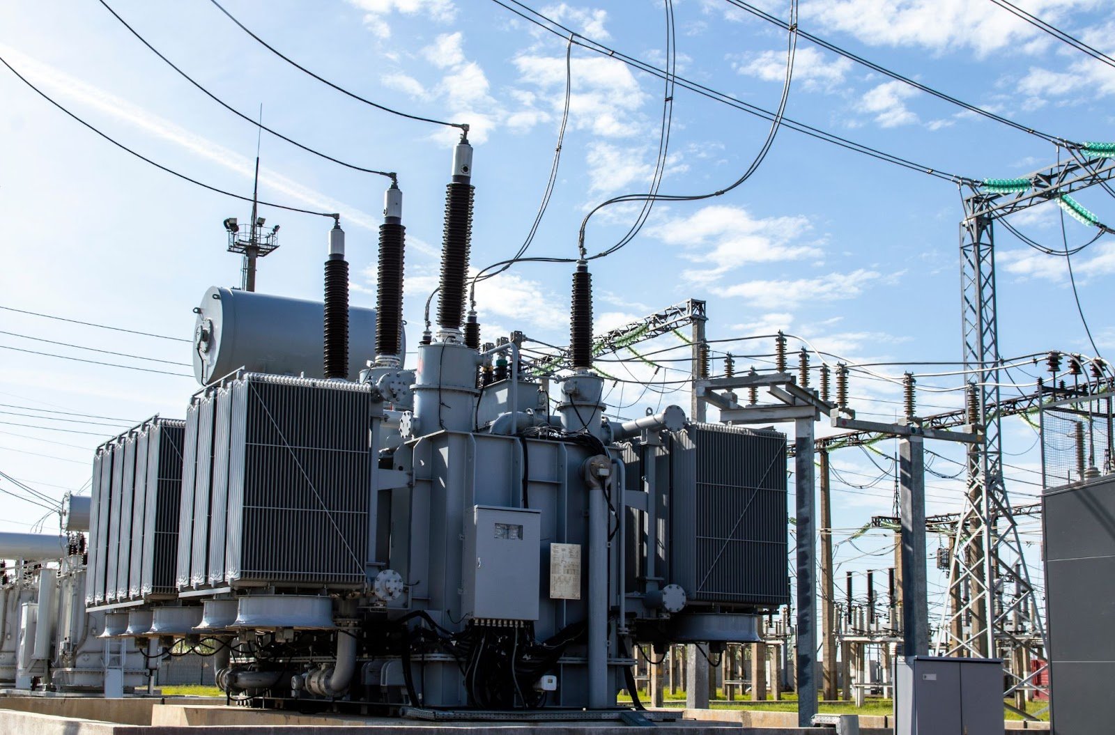
Rain matters most for earthwork. Clay soils near the river can turn soft quickly, so we schedule grading for drier periods when we can, protect open trenches and keep stockpiles away from drainage lines. Utility work belongs in the same plan. Our utility and substation site work package covers grading, grounding, foundations and fencing for a service point or a dedicated transformer yard, and we review it early if a parcel needs new capacity.
A small facility also needs a plan for operating through weather. We ask where staff will reach the building in an ice storm, how fuel is delivered and what happens to cable routes during high wind, then build those answers into the layout.
Sequencing cable, power and building work
Three calendars run side by side on an Anadarko job: the carrier's route work, the electric provider's service work and our own building work. They rarely line up on their own. We start the long approvals first, order transformers, switchgear and generators as soon as the load is known through long-lead equipment procurement, and build the shell and yard so each item has a place and a path when it arrives.
Where a carrier cannot reach the building by the date, we say so and offer options: a temporary link, a phased opening or a different entrance. Where the utility cannot energize on time, we adjust the sequence so that commissioning tests can begin on generator power. The owner sees one schedule with every dependency marked, and we update it every week.
Weighing a site in Caddo County?
Send us the parcel, the load and the carriers you want to reach. We will return a connectivity and access map, a power outline and a schedule with the approvals in order.
Common Questions
Why start with fiber access instead of the building?
Because the route cannot always be changed after the land is bought. Carriers decide where they will build, and crossings of roads, rail and creeks can delay a route by months. We map them first and tell the owner whether a parcel can be connected on the date needed.
Does the rail line help or hurt a data center site?
Both are possible. Rail corridors often carry fiber and can bring bulk materials, but a crossing needs the railroad's consent and vibration or noise may matter near sensitive equipment. We review the setback and the crossing before recommending a lot.
How does the Washita River affect the site?
Low ground along the river needs floodplain mapping and drainage design. We favor parcels above mapped levels, and we raise pads and detain runoff where a parcel is partly exposed. The county confirms what applies to a given lot.
What do temperature extremes mean for design?
Cooling plant has to be selected for the hottest days the site sees, and outdoor pipe, fuel and controls need freeze protection. We also plan concrete and earthwork around both extremes so that cold or heat does not damage finished work.
Who could use a small facility in Anadarko?
Public and tribal offices, regional carriers, agricultural businesses and healthcare providers are the likeliest users. Each needs modest capacity, reliable power and a diverse connection, and we size the first phase to match with room to grow.
Plan Your Oklahoma Data Center Project
Tell us about the site, the power and cooling plan and the schedule, and we will set up a review of scope, schedule, permits and inspections.
Request a Project Review